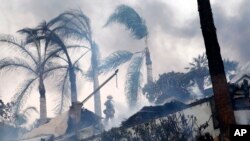
The wildfires raging in Southern California are being fanned by Santa Ana winds, the notoriously gusty and witheringly dry blasts that are linked to some of the worst infernos in the region's history.
A classic Santa Ana is formed when high pressure over the Great Basin causes dry air to flow out of the interior of the West in a clockwise rotation and enter Southern California from the northeast and move toward lower pressure off the coast.
The air speeds up as it squeezes through mountain passes and canyons, sometimes reaching ferocious speeds.
At the same time, the dryness causes relative humidity levels to plunge, often down to single-digit percentages, drying out living and dead vegetation and making it ready to burn.
Santa Anas are common in the fall, but can occur at other times of the year. They typically bring high heat, but can also remain chilly.
The current winds were predicted well in advance by the National Weather Service, which issued Red Flag warnings for critical fire danger starting late Sunday.
Meteorologists advised there would be potential for very rapid fire spread, long-range spotting and extreme fire behavior, all of which occurred in Ventura and Los Angeles counties.
Forecasters said it would likely be the strongest and longest Santa Ana wind so far this season, with gusts up to 80 mph and possibly persisting into Friday or Saturday.
Weather satellite photos showed smoke plumes blowing far out into the Pacific Ocean on Tuesday.
The origin of the wind's name has never been settled, but most discussions mention Santa Ana Canyon in Orange County, southeast of Los Angeles.
