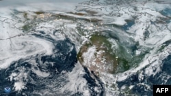
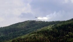
Wildfires in the Arctic have already released more planet-warming carbon dioxide this year than all of last year, with smoke plumes from the fires covering an area more than one-third the size of Canada, according to new data from the Copernicus Atmosphere Monitoring Service (CAMS).
Emissions from this year's fires break records set only last year. In both 2019 and so far in 2020, fires were more numerous, more intense and burned for longer than in any year since record keeping began 18 years ago.
“We’ve seen this rapid increase in fire activity in the Arctic Circle” in recent years, said Mark Parrington, senior scientist and wildfire expert at CAMS. “It’s kind of taken everybody by surprise. It’s such a rapid increase in a very short period of time.”
Although wildfires are a natural part of Arctic ecosystems, they’re usually “sporadic and short-lived,” Parrington said. Unusually hot, dry conditions in the Arctic this summer set the stage for larger, more intense fires.
“Fires are taking away the insulating soil layer that's on top of that permafrost, and then that permafrost starts to thaw,” said Elizabeth Hoy, support scientist at NASA Goddard Space Flight Center, who was not involved with the study.
“When the permafrost starts to thaw, you're releasing more carbon into the atmosphere. More carbon in the atmosphere can lead to more warming and more fires. So, we call that a positive feedback cycle,” she said.
Previous studies show that climate change is warming Arctic regions around two times the rate of other parts of the planet. According to Hoy, as cold and wet regions become dry and flammable, fires burn more readily. The fires can be started by human activity, lightning strikes, or “zombie fires” — fires that smolder beneath the ground over winter.
Satellite measurements from CAMS show that most of the Arctic wildfires are in Russia’s Sakha Republic region. But the smoke can travel thousands of miles from the blazes. Wildfire smoke contains pollutants that degrade air quality and affect human health. And dark-colored soot that settles on ice and snow absorbs more heat, accelerating melting of Arctic sea ice and sea level rise.
“We like to say that what happens in the Arctic doesn't stay in the Arctic,” Hoy said. “So it's not just the people that are living in the Arctic that are affected by these fires. When the permafrost starts to thaw and carbon is emitted into the atmosphere, that's not just affecting people locally, that's affecting all of us. So, we're all going to experience warming temperatures because we're losing so much carbon in the Arctic region.”
The increasingly intense fires in the Arctic are concerning because they burn deeper into the ground, melting permafrost and releasing “legacy” carbon that has accumulated over hundreds or thousands of years, said Douglas Morton, chief of the Biospheric Sciences Laboratory at NASA’s Goddard Space Flight Center, who was not involved with the research.
According to Morton, the report from CAMS matches what his own team has been finding.
“We too have noticed the uptick in fire activity and fire emissions. There’s some very clear evidence that 2019 and 2020 stand out as really anomalous years for burning in Eastern Siberia and above the Arctic Circle in particular,” he said.
CAMS uses satellites to monitor the intensity of wildfires around the planet based on their heat signals. The service also measures the composition of the Earth’s atmosphere to detect changes in greenhouse gases and air quality. According to Parrington, these different measurements help to build a complete picture of global wildfires and the emissions they produce.
Above average intensity wildfires have also been observed this summer in the U.S. states of California and Colorado.

