EDITOR'S NOTE: A previous version of this article misidentified Andrew Mew. A correction has been made.
Each spring, as the Alaska ice pack begins to loosen, Pacific walruses migrate north through the Bering Strait toward the colder waters of the Arctic Ocean. On their way, they pass Little Diomede Island, home of the federally recognized Native Village of Diomede (Inalik), nestled in the middle of the strait.
This is the time of year Inalik hunters set out in small boats, hoping to hunt and harvest enough walrus and oogruk (seal) to see them through the months ahead.
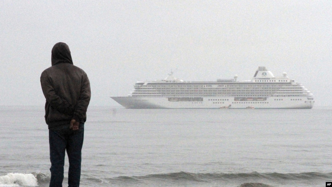
On June 14, Diomede's environmental coordinator Opik Ahkinga received a distressing Facebook message from an "outsider" asking whether she was aware that a large American cruise ship, Holland America's Westerdam, would be stopping for a "scenic tour" of Diomede in just five days.
"The Inalik Native Corporation and Native Village of Diomede have never given permission to the Holland America line to use Diomede Alaska as a scenic stop," Ahkinga told VOA. "If we're going to have ships come unannounced, there are going to be hunters out there still hunting."
The Westerdam, more than 285 meters (936 feet) long and 32 meters (106 feet) wide, was carrying some 1,700 passengers on a 28-day Arctic Circle cruise timed to coincide with the summer solstice.
It is a ship that would scare off any walruses in the area. Furthermore, where Diomede's hunters once used arrows and harpoons to hunt for food, today they use rifles, posing a danger to passing vessels.
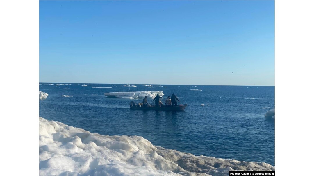
Photo show hunters at work in Bering Sea waters, Tuesday, June 18, 2024. Courtesy Frances Ozenna.
Directing traffic
A U.N.-designated international strait, Bering is a key passageway for domestic and foreign-flagged vessels sailing from the Pacific Ocean to the Arctic. Increased mining and petroleum activities to the north have led to a dramatic increase in ship traffic through the strait.
In summer 2016, the Crystal Serenity made history with a 32-day cruise from Anchorage through the Northwest Passage to New York, via Greenland.
"That was big news, and there's been an uptick in cruise ships and sightseeing ever since," said Steve White, executive director of the Marine Exchange of Alaska, a Juneau-based nonprofit that works to prevent maritime disasters.
In 2018, the International Maritime Organization (IMO), a U.N. Agency, adopted a set of routing measures for large vessels moving "in the region of the Alaska Aleutian Islands." Those included recommended routes, areas of concern and areas to be avoided.
In this July 14, 2017 file photo, The Finnish icebreaker MSV Nordica sails past the American island of Little Diomede, Alaska, left, and behind it, the Russian island of Big Diomede, separated by the International Date Line on the Bering Strait.
But these measures are voluntary, and while numerous groups including the Coast Guard and Marine Exchange monitor vessel traffic, "overall, it's not heavily regulated," White said.
VOA reached out to the Anchorage-based Cruise Line Agencies of Alaska's vice president Andrew Mew, who responded by email about the potential conflicts between ships and Native Alaskans hunting, fishing and conducting other subsistence activities.
"We make a practice of alerting vessels to the presence of subsistence activities when we are advised of them by the Coast Guard or other agency or organization," wrote Mew.
"There are some existent agreements in place regarding subsistence and commercial vessel activity, but … I am not aware of any agreement between a local Arctic organization and the cruise industry relative to subsistence activity."
He added, "When approached by members of the subsistence community, we are happy to pass along courtesy notifications to the vessels."
Recognizing that there is no centralized mechanism for communicating with Indigenous communities, the Marine Exchange has launched the Arctic Watch Operations Center, which White says is still in its "infancy stages."
Once fully up and running, Arctic Watch will monitor marine traffic and weather conditions, identify areas to avoid because of marine presence and share that information with vessel operators, Arctic communities, Alaska Native tribal governments and state and federal agencies.
This June, 2024, photo by filmmaker Bjorn Olson and provided by Opik Ahkinga, shows the town Inalik, located on the west coast of Little Diomede Island in the Bering Strait, the most remote community in the U.S.
Effort pays off
Cell phone service on Little Diomede is spotty in the best of times. On June 14, it was down altogether.
But Ahkinga is among the few Diomeders who has access to satellite internet. With time running short, she began sending emails in an attempt to divert the Holland America cruise ship.
VOA has seen copies of that email chain, which shows that her appeals were successful. Within two days, the ship changed course.
"While we are not aware of any notifications required to sail in this area of the Bering Strait, when we received a request from the Inalik Native Corporation to avoid that part of the sea, we agreed to alter the route and informed our guests of the change," a spokesman for Holland America told VOA in an emailed statement.
"As a cruise line that sails across the globe, we are committed to honoring and respecting the marine environment and communities who welcome us in our travel."